Ocean-monitoring satellite spots wildfire smoke from space | Space photo of the day for July 1, 2026
Space.com ·
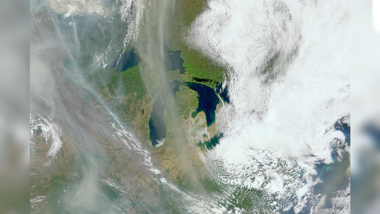
Swirls of wildfire smoke can be seen over Canada. (Image credit: NASA) Wildfires across the globe can be seen all the way from space. …
Swirls of wildfire smoke can be seen over Canada. (Image credit: NASA) Wildfires across the globe can be seen all the way from space. And one unexpected tool has come in handy to spot plumes of wildfire smoke: a satellite designed to study Earth's oceans. What is it? In this photo, we can see swirls of wildfire smoke over the Great Lakes in Canada. Fluffy white clouds float over the land and lakes, in contrast to the wisps of gray smoke, which float out from massive wildfires that ripped through North America. The photo was snapped in May of last year by NASA's PACE (Plankton, Aerosol, Cloud, and ocean Ecosystem) satellite. This seems logical, as it is an Earth-monitoring satellite, but what's surprising is that the orbiting spacecraft was actually designed to study and monitor Earth's oceans and atmosphere. In fact, the image itself was captured by PACE's Ocean Color Instrument, which does "hyperspectral" imaging, meaning that it observes the planet in hundreds of different wavelengths of light (in visible, near-infrared and ultraviolet). Why is it incredible? This image, among others, shows the incredible versatility of space technologies like PACE. While wildfire monitoring isn't its explicit purpose, images and data from this mission could be incredibly helpful in deepening our understanding of wildfires and how they spread. …
Original source: Space.com
Mentioned
NASA · Earth · Canada · Maryland · Michigan · North America · Goddard Space Flight Center