US-Indian Spacecraft Captures Mexico City Subsidence
NASA Breaking News ·
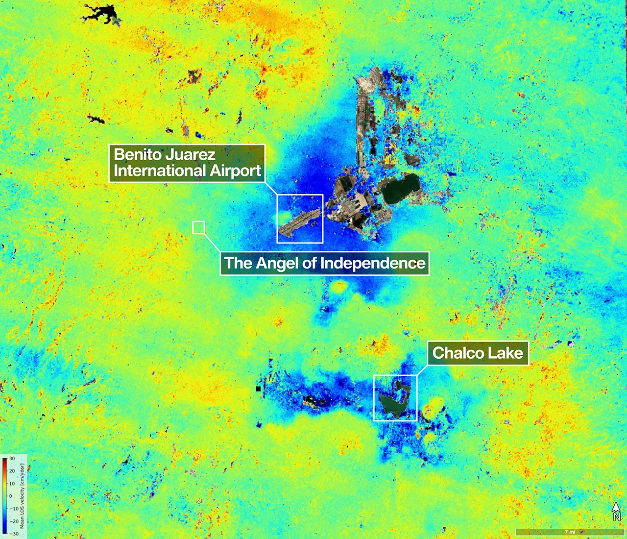
A scientist produced this map of land subsidence (sinking) in Mexico City using data from the NISAR (NASA-ISRO Synthetic Aperture Radar) mission captured between Oct. 25, 2025, and Jan. 17, 2026. …
A scientist produced this map of land subsidence (sinking) in Mexico City using data from the NISAR (NASA-ISRO Synthetic Aperture Radar) mission captured between Oct. 25, 2025, and Jan. 17, 2026. The region has been a well-known hot spot of subsidence for decades, and images like this help confirm that NISAR is performing as expected in its first year of operation. The dark blue color indicates areas found to be subsiding by more than half an inch (more than 2 centimeters) per month, due in large part to groundwater pumping, which has led to compaction of the dry, ancient lakebed on which the city was built. The yellow and red areas are likely residual noise signals that are expected to decrease as NISAR collects more data and refines its measurements. Two marshy ecosystems with ties to the country’s past can be seen in the image. The dark green oblong to the northeast of the airport is Nabor Carrillo, an artificial lake constructed over the now-extinct Lake Texcoco. Chalco Lake, a wetland located in a historically fertile region to the south, shares its name with a major body of water that was drained over a period of centuries to reduce flooding in the city. The ancient lake was a primary natural habitat of the Mexican Axolotl, an endangered species of salamander with the ability to regrow limbs. Another landmark pinpointed in the image — the Angel of Independence along the Paseo de la Reforma — was built in 1910 to commemorate 100 years of Mexico’s independence. …
Original source: NASA Breaking News
Mentioned
NISAR · Space · United States · Mexico · NASA · Mexico City · City