Satellites imaged an underwater volcano erupting — but scientists have no idea what's actually happening on the seafloor
Space.com ·
In early May, NASA satellites imaged an underwater volcanic eruption in the Bismarck Sea off the coast of Papua New Guinea. …
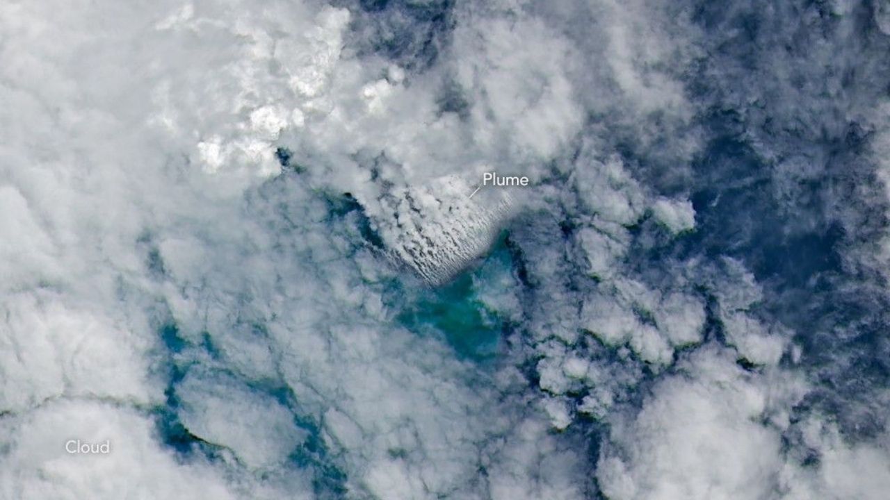
In early May, NASA satellites imaged an underwater volcanic eruption in the Bismarck Sea off the coast of Papua New Guinea. But when volcanologists looked to study the event, they reached a frustrating wall. There are no high-resolution maps of the seafloor here. That lack of baseline data made it more difficult for scientists to determine exactly how the eruption reshaped the seafloor or how large the volcanic structure may be. In fact, they aren't even sure which geological feature even erupted. Current theories suggest the eruption likely occurred along the Titan Ridge, about 10 miles (16 kilometers) southeast of a 1972 submarine eruption site. "The good news is that there are huge opportunities to explore and learn using both government and commercial satellite platforms already in orbit," Jim Garvin, the chief scientist at NASA's Goddard Space Flight Center, said in a statement . Existing satellite imagery allows scientists to analyze the miles-high ash plume, discoloration in the ocean water, rafts of the volcanic rock pumice emanating from the event, and even thermal events captured by the Visible Infrared Imaging Radiometer Suite (VIIRS) on NASA's Suomi NPP satellite. "There must be a lot of hot material near the surface to generate so many thermal anomalies," Simon Carn, a volcanologist at Michigan Tech, said in the statement. …
Original source: Space.com