NASA maps show Earth's brightest and darkest regions at night
CBS News Top ·
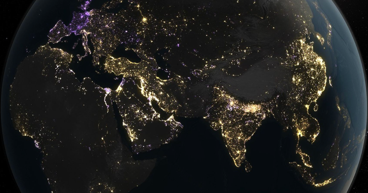
New maps from NASA using nearly a decade's worth of data show how the use of artificial light has shifted over the years. To make the maps, NASA researchers analyzed data collected by its "Black …
New maps from NASA using nearly a decade's worth of data show how the use of artificial light has shifted over the years. To make the maps, NASA researchers analyzed data collected by its "Black Marble" program , which uses a specialized sensor to capture low-light imagery of Earth at night. The data was collected by three different satellites between 2014 and 2022. Researchers expected to find "a gradual increase in artificial light at night" over the years, NASA said in a news release . What they discovered was "much more nuanced patterns" of light radiance. "The analysis portrays a world flickering with industrial booms and busts, construction, and blackouts, as well as more gradual shifts, such as policy-driven retrofits," NASA said. A rendition of the Black Marble data collected by NASA. Purple shows spots of dimming, while gold shows spots of brightening. NASA Earth Observatory/Michala Garrison The researchers found that each location examined by the sensors underwent several distinct shifts over the nine years data was collected. During that time, radiance increased 34%, while dimming offset it by 18%, the researchers said. Both lighting and dimming "markedly intensified over the past decade," the researchers said in a study published in the academic journal Nature . …
Original source: CBS News Top
Mentioned
NASA · India · China · Earth · Ukraine · East Coast · West Coast · United States