Mexico City is sinking up to 14 inches per year, satellite images show
Space.com ·
Mexico City is sinking, and a powerful new orbiting satellite that's monitoring changes in land levels all across the globe has discovered how quickly this is happening. …
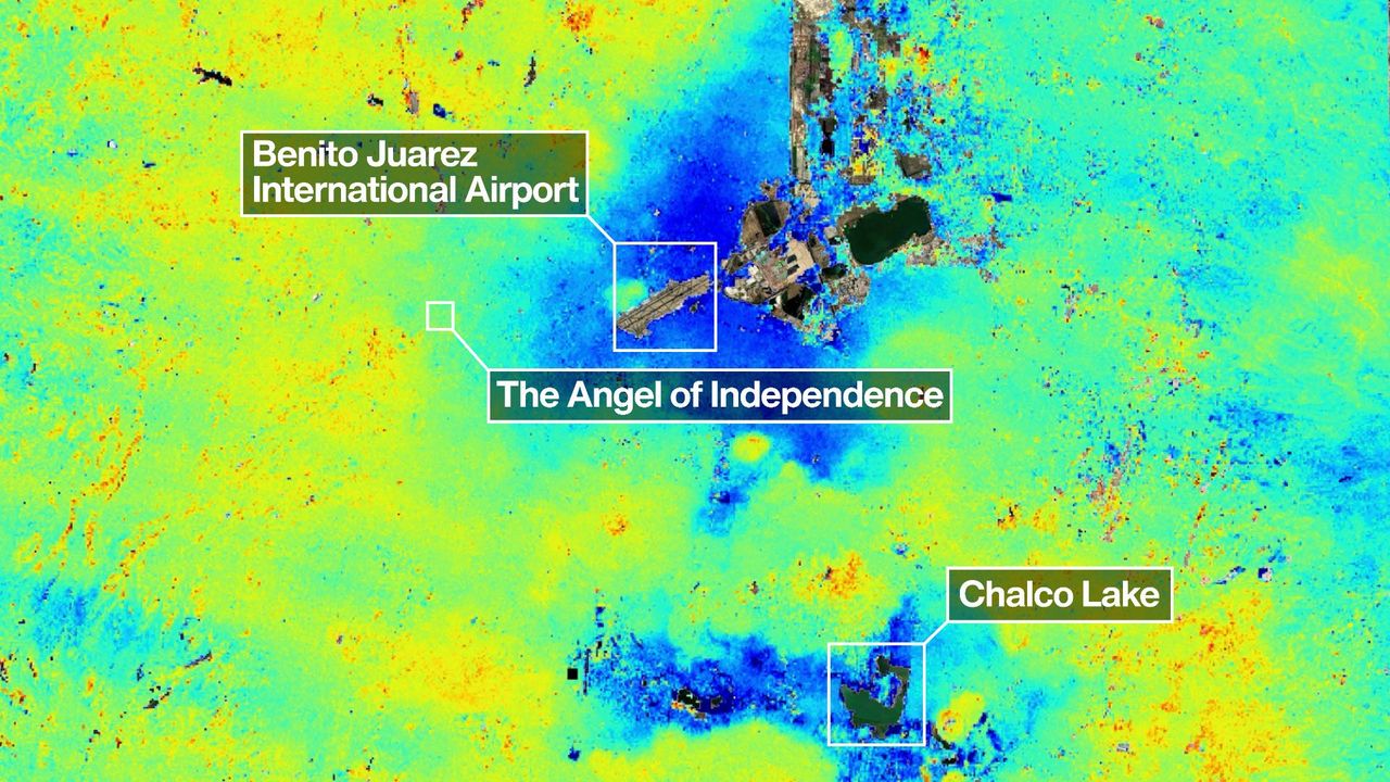
Mexico City is sinking, and a powerful new orbiting satellite that's monitoring changes in land levels all across the globe has discovered how quickly this is happening. It's all thanks to the mission's innovative dual-frequency band radar. NISAR, the NASA–ISRO Synthetic Aperture Radar satellite, launched on July 30, 2025 as a joint partnership between NASA and the Indian Space Research Organisation (ISRO). Its mission is to track in real-time surface changes on Earth, from ground subsidence and the retreat of glaciers to and the movement of tectonic plates and the spread of wildfires — all to a precision of within a centimeter. "Mexico City is a well-known hot spot when it comes to subsidence, and images like this are just the beginning for NISAR," said David Bekaert, of the Flemish Institute for Technological Research in Belgium and the NISAR science team, in a statement . It has been known since 1925 that much of the city, home to 20 million people, is sinking at a rate of up to 14 inches (35 centimeters) per year. This is the result of the city being built above an aquifer, or an underground layer of permeable rock and sand, left behind by an ancient lakebed — and the resulting groundwater pumping and the weight of its urban sprawl is compressing those sedimentary layers. The result is damage to buildings and infrastructure, such as the Mexico City Metro system. …
Original source: Space.com
Mentioned
washington dc · Earth · Belgium · JPL-Caltech · NASA Headquarters · Mexico City Metro · Indian Space Research Organisation · Flemish Institute for Technological Research