Drone radar could help spacecraft pinpoint where to drill for water on Mars, scientists say
Space.com ·
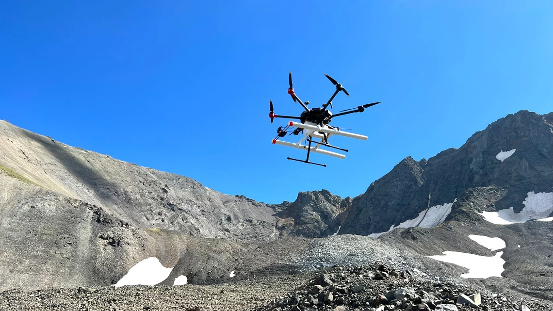
A new study suggests the search for usable water on Mars may soon rely on an unexpected tool: drones equipped with radar, flying just above the surface to peer underground in ways orbiters cannot. …
A new study suggests the search for usable water on Mars may soon rely on an unexpected tool: drones equipped with radar, flying just above the surface to peer underground in ways orbiters cannot. Researchers led by the University of Arizona have shown that drone-mounted ground-penetrating radar can map buried glaciers on Earth in remarkable detail, offering a blueprint for how similar techniques could be used on Mars . The work focuses on glaciers in Alaska and Wyoming that closely resemble debris-covered ice deposits identified on the Red Planet, according to a statement from the university. "If you want to make decisions about where to drill on Mars, you need to know if the ice you're trying to find is under one meter of debris or 10," Roberto Aguilar, lead author of the study and a doctoral researcher at the University of Arizona Lunar and Planetary Laboratory, said in the statement . "That's the kind of information a drone-based system could provide." A research drone equipped with ground-penetrating radar takes off for a reconnaissance flight on Galena Creek Rock Glacier, Wyoming. (Image credit: Michael Daniel) For decades, Mars missions have relied on orbital radar instruments, such as the Shallow Radar sounder (SHARAD) aboard NASA's Mars Reconnaissance Orbiter , to detect subsurface ice. These systems have confirmed that vast amounts of water ice are locked beneath layers of rock and dust, particularly in the planet's mid-latitudes. …
Original source: Space.com